Grönviksvägen 124167 76 BrommaSweden, Suécia
Termos de venda
Ver demonstração
O leilão terminou
|
LOTE 47:
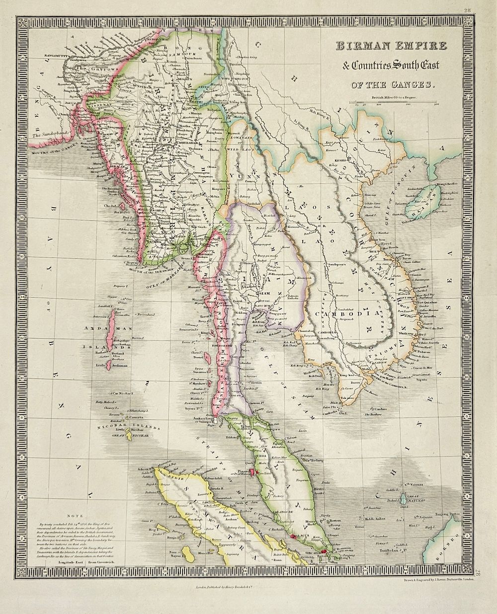
James Dower (active 1838–1846) – Map of the Birman Empire and Countries South-East of the Ganges – Engraving (c.1838)
mais......
|
|


|
Preço inicial:
300
Skr
Preço estimado :
2 000 Skr - 3 000 Skr
Comissão da leiloeira: 23%
|
James Dower (active 1838–1846) – Map of the Birman Empire and Countries South-East of the Ganges – Engraving (c.1838)
"Birman Empire Countries south East of the Ganges"This map shows the Birman Empire (Burma) and the neighboring regions south east of the Ganges, including parts of Siam (Thailand), Laos, Cambodia, Malaya, and the Andaman and Nicobar Islands. It reflects colonial boundaries and major territorial adjustments following the 1826 Treaty of Yandabo, which concluded the First Anglo-Burmese War. The note at the bottom left explains the cession of key provinces like Aracan and Tenasserim to the British. The map was published by Henry Teesdale Co. and engraved by James Dower.James Dower was a British cartographer and engraver active during the mid-19th century, best known for his finely detailed maps published through London-based firms such as Henry Teesdale Co. His work often focused on thematic and regional atlases, with a particular emphasis on political geography during the age of empire.Artist or Maker: James DowerDimensions: 49 cm x 39 cmMedium: EngravingDate: c.1838Condition Report:This work is in good condition overall. There may be a few minor imperfections or fox or mottled marks to be expected with age. Please review the images carefully for condition details, and feel free to contact us with any questions or for a comprehensive condition report.
